


Trælanípa Cliff
Jump to chapter
Published: 03/06/2021
Reading time: 5 minutes
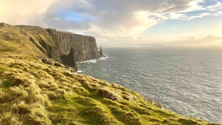
Trælanípa is a steep cliff on Vágar Island in the beautiful Faroe Islands. The cliff treats hikers to one of the most renowned views in the Faroe Islands.
The scenery at Trælanípa is among travellers’ favourite spots to visit in the Faroe Islands. From Trælanípa Cliff, you can see Lake Leitisvatn, which is the largest lake in the Faroe Islands. From the top of the cliff, it looks as if the lake is floating above the wild North Atlantic ocean. For this reason, the lake is often called “The Lake Above the Ocean”.
The name of the cliff, Trælanípa, translates to “The Slave Cliff”. According to local folklore, the cliff got this name during the Viking Age when Vikings pushed old, disobedient and sick slaves off the cliff edge.
Getting to the Trailhead
You will find the trailhead to Trælanípa Cliff very close to Vágar Airport. It takes 10 minutes to drive from the airport to where the trail starts. The trailhead is located next to the village of Miðvágur. When coming from the airport, look for the centrally located church in Miðvágur, and turn right along the road in front of the church, Follow the winding road up to the parking lot. Next to the parking lot is a small café and public toilets.
As you will be in the great outdoors for around three hours, you might want to bring some snacks with you. You can buy some in the café at the trailhead or in the grocery stores or gas station in the village of Miðvágur.
Trail Admission Fee: In order to hike to Trælanípa Cliff, there is a mandatory trail admission fee of 200 DKK. This can be paid by card or cash at the café by the trailhead. The fee does not include a guide.

The Hike to Trælanípa Cliff
In order to get to the famous vantage point, you have to hike a well-trodden 3-kilometre (1.86 miles) trail for around one hour.
Hiking to the famous viewpoint is fairly easy. There is hardly any elevation gain along the route except for the very last part when you hike up the cliff to the viewpoint. The cliff is 142 metres (466 feet) high, making it the lowest mountain on Vágar Island. Nevertheless, the climb up is quite steep.

Most people will consider the hike from the trailhead to the cliff more like a walk than a real hike. Small children can easily join this hike.
On the way to Trælanípa Cliff, you will walk along the scenic Lake Leitisvatn. This is the same lake that you will see perched above the ocean from the sheer cliff. The lake floats 38 metres (125 feet) above the ocean. Most of the lake is up to 60 metres (197 feet) deep, so a huge part of the lake is actually under sea level.

Other great views near Trælanípa Cliff
Right before you get to the point of the hike where you start climbing up the hill, you will have a great view of the cliff itself. There is a wooden bench here where you can relax and soak in the breathtaking surroundings.
Another great attraction next to the cliff is Bøsdalafossur Waterfall which drops from the lake into the ocean below. To get to the waterfall from the cliff, simply hike down it on the opposite side of where you hiked up, and head for the rocks below the cliff. Go down far enough to view the waterfall cascading down the cliffs into the ocean.
Behind Bøsdalafossur Waterfall, you can see the towering Geituskorardrangur Sea Stack shooting out of the ocean. It is possible to see the sea stack from above, but it requires crossing the waterfall and hiking up the hill on the other side. Crossing the waterfall is only possible in very mild weather.

Services near Trælanípa Cliff
As the Lake Above the Ocean is one of the main attractions in the Faroe Islands, there are several services nearby. The Trælanípa Cliff viewpoint itself is pure nature. All the services listed below are located in the nearest village, Miðvágur, and at the trailhead.
- Grocery store: Yes
- Café: Yes
- Public toilet: Yes
- Parking lot: Yes

More travel blogs


Popular tours
-
New Tour
Suðuroy Island | The Photography Tour
Tour startsTórshavnDuration9 hours -
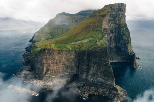
James Bond Sightseeing Tour
Tour startsKlaksvíkDuration8 hours -
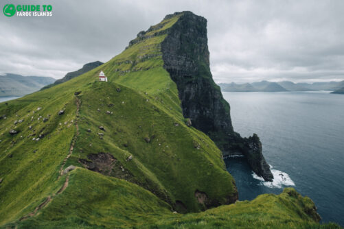
From Tórshavn: Kallur Lighthouse on Kalsoy Island
Tour startsTórshavnDuration8 hours -
Personal Photographer Tour
Tour startsTórshavnDuration6 hours -
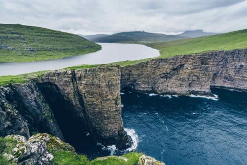
Unbelievable 6 Hour ‘Lake Above the Ocean’ Tour
Tour startsTórshavnDuration6 hours -
Eat Local on Private Guided Day Tour
Tour startsTórshavnDuration7 hours -
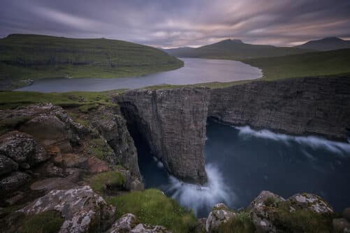
Essential 6 Hour Highlights of Vágar Island
Tour startsTórshavnDuration6 hours -
Vibrant 4 Hour Viðoy Island Tour
Tour startsTórshavnDuration4 hours -
Scenic 7 Hours Sandoy Island Day Tour
Tour startsTórshavnDuration7 hours -
Classic 4 Hour Northern Isles Tour
Tour startsKlaksvíkDuration4 hours -

Unforgettable 10 Day Self Drive Tour of Faroe Islands with Top Attractions
Tour startsVágar AirportDuration10 days -
Incredible 3 Day Faroe Islands Highlights Package
Tour startsTórshavnDuration3 days -
Northern Islands | The Photography Tour
Tour startsTórshavnDuration7 hours -
4 Day Winter Package | Best of Faroe Islands
Tour startsVágar AirportDuration4 days -

Refreshing 3 Hour Boat Tour including Fishing
Tour startsKaldbaksfjørður FjordDuration3 hours


Frequently asked questions
What is Trælanípa Cliff?
Trælanípa Cliff is a perpendicular rock wall on Vágar Island that rises 142 metres (466 feet) out of the sea. It is best known as the viewpoint for the “Lake Above the Ocean”.
What does Trælanípa Cliff mean?
Trælanípa translates to “Slave Cliff”. According to legend, the name dates back to the Viking Age, when old and sick slaves were supposedly pushed off the cliff.
How tall is Trælanípa Cliff?
Trælanípa Cliff rises 142 metres (466 feet) from the sea.
What is the Lake Above the Ocean?
From Trælanípa Cliff, an optical illusion makes Lake Sørvágsvatn, also called Leitisvatn, appear to float high above the ocean. The lake is the largest in the Faroe Islands at 3.4 square kilometres.
Where is Trælanípa Cliff located?
Trælanípa Cliff is on the south coast of Vágar Island, at the end of Lake Sørvágsvatn. The trail starts on the outskirts of the village of Miðvágur, a short drive from Vágar Airport.
How do I get to the Trælanípa Cliff trailhead?
On the main road in the village Miðvágur, turn onto the road by the church and follow the signs to “Trælanípa/Bøsdalafossur” until reaching the main gate and reception, where the trail admission fee is paid. Parking is available at the trailhead.
How much does it cost to hike to Trælanípa Cliff?
A trail admission fee of 200 DKK is required per person, paid to the land administrators who have a payment gate at the trailhead in Miðvágur. Credit card and cash accepted.
Do I need a guide for Trælanípa Cliff?
No. Trælanípa Cliff can be visited without a guide, but all visitors must pass through the main gate and check in at the land administrators’ reception at the start of the trail. Guided tours to Trælanípa Cliff are available throughout the year combining other highlights of Vágar Island.
How long is the hike to Trælanípa Cliff?
The walk from the trailhead to the Trælanípa Cliff viewpoint takes around 40 minutes. The full round trip including Bøsdalafossur Waterfall is about 7 km (4.4 mi) and takes roughly 2.5 hours, including time to soak in the views.
How difficult is the Trælanípa Cliff hike?
The hike is easy. The terrain is almost flat, apart from the short climb up to Trælanípa Cliff itself at 142 metres (466 feet).
What else can be seen from Trælanípa Cliff?
In clear weather, the view from Trælanípa Cliff reaches the southernmost part of Streymoy Island as well as Hestur Island, Koltur Island, Sandoy Island, Skúvoy Island and Suðuroy Island.
What is Bøsdalafossur Waterfall?
At the end of Lake Leitisvatn, the 30-metre (98 feet) Bøsdalafossur Waterfall flows directly into the Atlantic Ocean. It is a short walk from Trælanípa Cliff along the same trail.
What is Geituskorardrangur Rock Wall?
Geituskorardrangur Rock Wall is a sea stack visible from the same viewpoint as Bøsdalafossur Waterfall, near Trælanípa Cliff.
Are there any historical remains near Trælanípa Cliff?
Yes. Near Bøsdalafossur Waterfall there are ruins of buildings left on Vágar Island by the British after World War II.
Is Trælanípa Cliff safe?
The cliff edge is steep and there is no fence, so visitors should keep a safe distance from the edge and stay on the marked gravel path.
Is Trælanípa Cliff worth visiting on arrival or departure day?
Yes. The trailhead in Miðvágur is only a few minutes from Vágar Airport, and the round trip fits easily into a day of arrival or departure in the Faroe Islands.
Other interesting Attractions