The Ultimate Guide to Eysturoy Island
Jump to chapter
Published: 03/06/2021
Reading time: 43 minutes

Are you wondering what to do on Eysturoy Island? How is it like visiting Eysturoy Island? Are there any must-do attractions to experience? What activities are available? Read on to find out how to spend your time on Eysturoy Island.
- See the most popular sights of the Faroe Islands on this 6 Day Summer Package
- Read this to discover the Top 10 Faroe Islands Tours
- Get to know 18 Things for your first Trip to the Faroe Islands
- Find your Faroe Islands Car Rental here
Among the eighteen islands that make up the Faroese archipelago, Eysturoy Island (East Island) is the second largest in both size and population. Before you book your trip, you will find out that Eysturoy is directly on the path for almost any visitor to the Faroes.
Eysturoy Island is joined to Streymoy Island, the largest island, by bridge, and the undersea tunnel Eysturoyartunnilin. The underwater road network links the most densely populated region directly with the capital of Tórshavn.
Another undersea tunnel from Eysturoy Island connects to Klaksvík and the rugged and remote Northern Islands. This makes Eysturoy Island easy to reach and almost inevitable when visiting the Faroe Islands.
About Eysturoy Island

The island is so much more than a link in the Faroese road system. Eysturoy Island is home to the Faroe Islands’s highest mountains, ancient Viking settlements, and what may be the world’s most unique music festival.
From picturesque villages like Eiði, Gjógv, Funningur and Elduvík in the north, to the bustling population hubs in Runavík and Fuglafjørður in the south, and plenty to discover in between, Eysturoy Island is an unforgettable part of any visit to the Faroe Islands. This itinerary will lead you around the island’s many twists and turns, starting at the bridge from Streymoy and leaving you in Leirvik, the gateway to the Northern Islands.
The Bridge over the Atlantic

You can enter Eysturoy Island with the Brúgvin um Streymin (the bridge over the current). In all of the Faroes, this is the only bridge that connects two islands, and so the locals like to call it “the Bridge over the Atlantic.”
The sound between Streymoy Island and Eysturoy Island , simply called Sundini (the sounds) in Faroese, is the longest in the Faroes, and mostly deep and peaceful. But the bridge crosses at Streymurin (the current), which is the narrowest, and shallowest, point in the channel. Only small boats can pass here, and the current can be strong enough to form spectacular and perilous eddies.
Seafood Shop on Eysturoy Island

Turn left when you cross the bridge, and you’ll pass through a few small villages as you head north. The villages of Norðskáli and Oyrarbakki are located right where the bridge lets out.
As you head north along the coast, you can take either the more narrow road through Norðskáli. This is definitely worth is as once you have passed the beautiful church in the village, you will get to what used to be a hidden Seafood shop. People enjoyed lovely fish & chips or opted for some fresh produce from the pristine North Atlantic Ocean to prepare themselves. The place closed in 2026.

Next up is the the village of Ljósá. This small settlement sits along the seaside and you can either pass through it on the village road or take the main road just above the houses here.
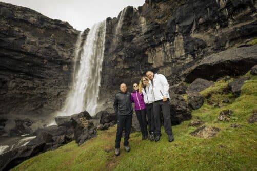
Keep an eye on Streymoy Island across the Sound to catch sight of Fossá Waterfall (the waterfall in the river of waterfalls). This is the waterfall with two cascading stages and it comprise the highest waterfall in the Faroe Islands. You get great views of the waterfall from Eysturoy Island
Eiði

Your first big stop on Eysturoy Island is the village of Eiði. The village makes a charming impression, with colourful houses spread out over the flat isthmus that gives the village its name, the calm sea sparkling and high mountains rising all around.
First settled by the Vikings in the 9th century, Eiði was once the second biggest town in the Faroe Islands. The town is still a healthy fishing community today.

The village church has a lovely painted interior and model ships hanging from the rafters. These votive ships, meant to keep locals safe at sea, are a common sight in the Faroes—as are memorials for those lost to the waves.
Eiði’s heritage museum, Látrið, is located in a restored turf-roof farmhouse. Three rooms of historical artefacts are open by appointment and offer a glimpse into Faroese life in the past.
Eiði Football Stadium
There are several nice excursions available from Eiði, offering spectacular views of fjords and mountains, as well as stories around every turn. Here are some of the best tours that you can do.
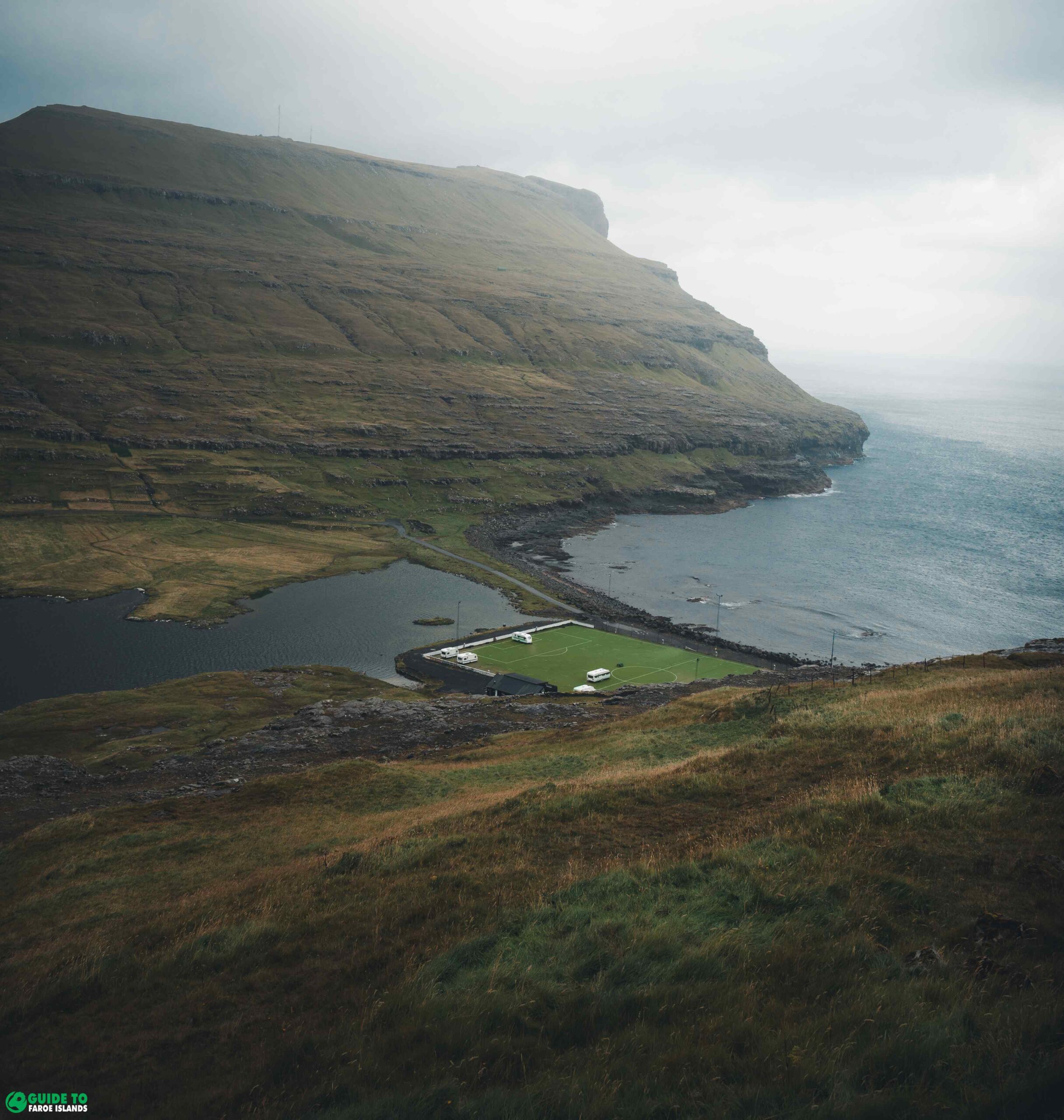
An easy, flat walk around the pretty lake to the north of the village takes us to Eiði’s former football field, stunningly situated between the lake and the rocky seashore. It has many names, from the loneliest to the most beautiful football field in the world. Today it is possible to camp on the pitch in the summer.
The Nykurin Folklore in Eiði

Walking back towards the village, you’re likely to see swans swimming in the peaceful lake, which the locals call Tjørnin; but watch out for the monster that lurks beneath the surface. This is one of several Faroese bodies of water home to a Nykur, a dangerous, shapeshifting creature that can drag the unwary into the depths to drown.
It is said that if the sign of the cross could be made on a Nykur, he could be put to work, using his great tail to drag rocks from the mountains to build fences or houses. In this way a Nykur brought big and beautiful rocks to the churchyard in Eiði, which can still be seen today.
But the Nykur of Eiði was no benevolent creature. Taking the shape of a horse, the legend says he persuaded some curious children to climb onto his back. More and more children came, but somehow, no matter how many clambered onto the horse’s back, there always seemed to be room for one more.
When everyone in the village had climbed up on the Nykur’s back, the Nykur headed for the water. They only escaped their watery graves by the chance uttering of the Nykur’s name by a small child, which of course broke the spell—the Nykur threw all the villagers off his back before disappearing into the water.
Nature Attractions near Eiði

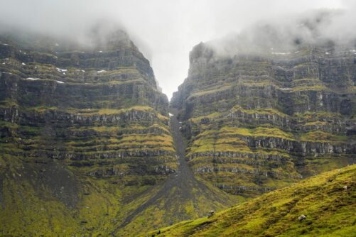
Another nice walk rises above the village up to Eiðiskollur Cliff. The summit shoots 352 m / 1155 ft above sea level and is crowned by the ruins of a World War II watchtower.
The views here are spectacular in all directions. From shining sea to the commanding slopes of Mount Slættaratindur, the Faroes’ highest peak. Looking down, you can also catch an unusual view of one of the Faroes’ most photographed sights, the sea-stacks Risin og Kellingin (The Giant and the Witch).
According to legend, one night a giant and a witch came from Iceland to steal the Faroe Islands and drag them home. They tied a rope around Eiðiskollur and started pulling, but things didn’t go according to plan.
First, the rock split, causing a crack that can still be seen today. Then the sun came out and turned the giant and the witch alike into stone, leaving the famous sea-stacks where they stood.
Crossing the Mountains on Eysturoy Island

From Eiði, take the mountain road up a winding course into the moors. Keep an eye out for the viewpoint, which features a free looking glass. From here you can get another good view of Risin and Kellingin. To your right is the lake Eiðisvatn, which collects water from large swaths of Eysturoy Island to supply the Faroes’ largest hydroelectric plant below.
When you reach the pass of Eiðiskarð, you’ll have Vaðhorn (726 m / 2382 ft) on your right, and mighty Mount Slættaratindur (882 m / 2894 ft), the highest peak in the island group, rising on your left. Look for the parking place if you are up to the climb, which is tiring but not very difficult. At the top you’ll find the surprisingly wide, flat peak that gives the mountain it’s name.
Sensational views from Mount Slættaratindur
The views from Slættaratindur are breathtaking, plunging down to the sea in all directions. On a clear day, you can see all 18 islands in the Faroe Islands from the peak.
People like to hike up and spend the shortest, brightest night of the nordic year atop the archipelago. This is during the summer solstice.

On an exceptionally clear day, locals will tell you that it is possible to see all the way to Iceland, where the sun glinting off a glacier 550 kilometers away would form the longest sightline on earth. This fact has appeared in the Guinness Book of World Records, but whether it is truly possible is a matter of some debate. The best way to be sure is to hike up and have a look for yourself!
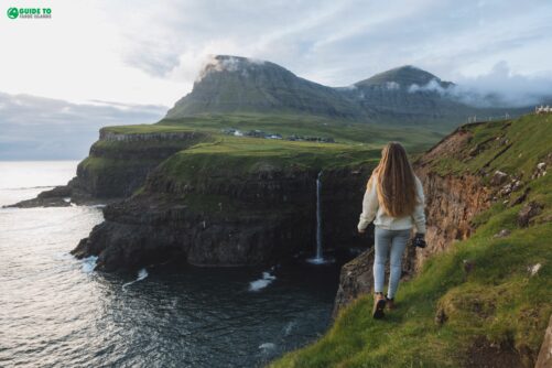
Passing through Eiðisskarð, you’ll find another stunning view, with your first glimpse of the Kalsoy Island in the distance. Don’t descend yet into Funningur, as lovely as it looks at the foot of the mountain, but hang left and enjoy a drive down through a lovely valley to the village of Gjógv, a highlight in any Faroese itinerary.
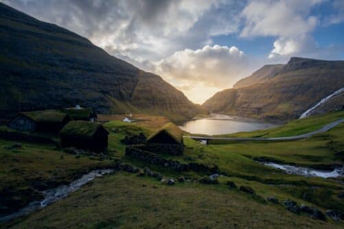
Gjógv – A Eysturoy Island Highlight

Gjógv is one of the most famous places in the Faroe Islands, and with good reason. With its brightly colored houses, fantastic views over the sea to the Northern Islands, idyllic countryside setting, and, of course, the village’s namesake natural harbor, the village seems almost too picture-perfect to be real.
In summer Gjógv is a wonderful place to be. Many locals have a summer home in the colourful village where they spend much time in the summer season.

Tarvellers come to the village to see the gorge, take part in the Faroese cultural evenings, and hike the surrounding countryside. Gjógv has a tranquil feeling to it.
It’s well worth spending the night at the Gjáargarður Guesthouse. This grass-roofed building offers a variety of rooms, a restaurant, and also a campsite, so you can slow down and enjoy the village at a leisurely pace.
The Sea Gorge in Gjógv

Walk down into the gorge to marvel at the natural harbour and see the tiny incline railway, technically the only railway of any kind in the Faroe Islands. Locals used to haul boats up and down to the water using the railway. You will find church services and concerts down in the gorge from time to time, so look for a current schedule of events.
The little Gjáarkaffi at the end of the rail-line sells waffles, ice cream, coffee, beer and other light refreshments on summer days. Winter in the Faroe Islands closes the place for the season.

A path alongside the western side of the gorge leads to a different viewpoint of the gorge. You an also walk along the opposite edge of the gorge for a great perspective of the gorge with the village as a backdrop.
Stroll around the village and enjoy the variety of brightly colored houses and turf roofs. Try to find the wading pool, the likes of which was once common in Faroese villages for teaching children to swim and splashing around on the warmest summer days, but are rarely found today. The local school, built of boulders in 1884, is also worth a look.
The Church in Gjógv

The church in Gjógv was the first ever to conduct services in Faroese. A painting inside shows Jesus walking on water, but uniquely pictures him off the distinctive coast of Gjógv itself.
Just across the street, a seafarer’s memorial lists dozens of names, all men from the village who were lost to the deeps. This includes a particular tragedy in 1870, when two boats sank, killing half of the village’s adult male population. A sculpture of a mother and two children looking out towards the ocean reminds the visitor of all the widows and orphans these men left behind.

Gjógv is one of many small villages in the Faroes that has seen dramatic population declines over the course of the last century. The village once boasted 13 fishing ships and 50 pupils in the local school.
Today, the school has no pupils, and fewer than 30 people call Gjógv home year-round. Given its settlement’s picturesqueness, the total number of visitors to the place exceeds its population during the summer season from April to October.
Remotely Located Settlement

Although Gjógv is on Eysturoy Island, its relative isolation gives it more in common with the more remote parts of the Faroes, to the extent that the Útoyggjastevna, the festival for the small outer islands, is sometimes held in Gjógv. Like on many of these outlying islands, the future of Gjógv seems destined to be more tied to summer tourism than in maintaining a year-round population.
You will find Faroese Cultural Evenings in Gjógv regularly in the summer, offering visitors the chance to taste Faroese delicacies and try out the traditional Faroese style of dancing and ballad-singing. Check this year’s Summartónar guide to find the dates for cultural evenings as well as other concerts and cultural events throughout the islands.
Hikes from Gjógv

Gjógv is a great place for those wanting to go for a hike. To the east, the mountains Tyril and Middagsfjall come with gorgeous views of the Funningsfjørður Fjord. Near Middagsfjall you will find the popular Hvíthamar Vantage Point from where you will have a great view of the fjord and surrounding mountains.
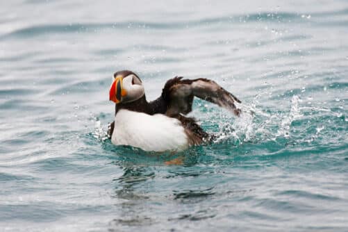
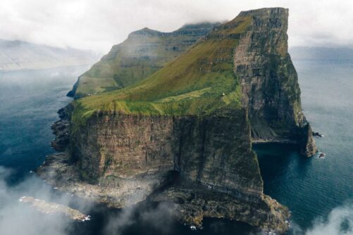
To the northwest, the little peak of Fjallið provides a nice bird’s-eye view of Gjógv, and continuing further into the wild valley of Ambadalur reveals the alluring Búgvin Sea-Stack, the highest free-standing sea-stack in the archipelago. This is an excellent trip for birdwatchers, with the high valley moors filled with whimbrels, snipes, great skuas, and oystercatchers, and Búgvin Sea-Stack serving as a veritable sky-scraper for seabirds, including fulmars, guillemots, and even puffins.
Funningur

Retrace your steps from Gjógv, and this time take the dramatic switchbacks down into Funningur. This settlement is notable for being the home of the Faroe Islands’ first inhabitant, Grímur Kamban. There is a statue of the first settler near the church in Funningur by sculpturist Hans Pauli Olsen.
Funningur is a pretty village with a stream running through it. A traditional Faroese church sits beautifully where the river meets the sea. You will have a great view of the surrounding mountains when standing in front of the church in Funningur.
Elduvík

From Funningur, drive around Funningsfjørður to Elduvík. Don’t miss the lovely views back across the fjord to where Slættaratindur rises over Funningur in perfect symmetry.
If the weather is good, there’s a nice spot to stop for a picnic along the way, with a stone table and chairs. Elduvík is a quaint village split into two by a river in front of a rocky beach.

The brightly coloured houses in Elduvík are pressed closely together for protection against the elements. Almost as isolated as Gjógv, and even quieter, Elduvík offers basic camping and picnic facilities, and fantastic elemental scenery.
The ocean is rough here, and it can be quite an experience to watch the surf roll onto the beach. A few minutes walk to the west, a dramatic canyon opens up to the swirling sea currents.
The Story of Marmennil in Elduvík

A strange story comes from Elduvík of a farmer named Anfinnur and a creature called Marmennil. Marmennil looked much like a person, but was small, had long fingers, and lived at the bottom of the sea.
He used to tease the local fisherman by eating their bait and breaking their lines by hooking them to the sea-bed. But one day Anfinnur pulled Marmennil up into his boat and made the sign of the cross, which tamed him. Anfinnur took Marmennil home with him, then brought him along whenever he went fishing.
Marmennil would laugh and play in the boat, bringing them good luck with their catch. This went on for a long time, but one day in bad weather Anfinnur forgot to make the sign of the cross on Marmennil, so the creature slipped overboard into the sea and was never seen again.
There is a statue of the Marmennil story in Elduvík. The statue sits by the seaside and here you will have a beautiful view of the seascapes.
If you’d like to stretch your legs in Elduvík, you can follow the river up the peaceful valley for a nice walk in the fresh air. Or you can hike the old village path to Oyndarfjørður, the next place on our list, where locals used to attend church services before Elduvík got its own church.
Oyndarfjørður

When you finish in Elduvík, follow the road back to the little village of Funningsfjørður. Here you’ll rejoin the main 10 road briefly before turning left towards Hellurnar and Oyndarfjørður.
Oyndarfjørður is a pleasant village with a lovely church—and a mysterious secret. Down by the shore, you can watch as two huge boulders rock gently back and forth with the pull of the ocean. These are the Rinkusteinar (Rocking Stones). Exactly why and how the stones move like this is still unknown, but the legend says that they were once pirate ships, threatening the village, and a local witch turned them into the restless stones that can be seen today.
From Hellurnar, a small village in the same valley, you can hike the old village path to Fuglafjørður, one of Eysturoy’s larger towns, which you’ll otherwise come to towards the end of this guide.
Skálafjørður – The Western Shore of Eysturoy Island

After visiting the wild nature and remote villages of northwestern Eysturoy, you now shift gears to the more densely populated southeastern part of the island.
The calm waters and fertile hillsides of Skálafjørður Fjord, the longest of its kind in the Faroe Islands, have given rise to a large number of villages, together comprising over ten percent of the Faroese population. This area is growing even more now that the undersea tunnel Eysturoyartunnilin connects both sides of the fjord directly to Tórshavn.
Where the road splits at the bottom of the fjord at Skálabotnur, there’s a good chance to replenish your petrol or grab a sandwich and snacks from the grill at the Effo station. Then head right towards Strendur.
Skála
The village of Skála along the way has a large harbour and a few stories attached to it. Throughout the Nordic countries stories are told of the ghosts of unbaptised children, often illegitimate or otherwise undesired, who were murdered or left to die of exposure. These sad phantoms haunt the locales in which they died until they have been given some sort of acknowledgement, such as a proper burial in a churchyard or a name.
In the village of Skála, beside a path coming up from the harbor, sits the Loddasasteinur. One of these child ghosts, called niðagrísur in Faroese, was known to haunt this stone. He would lay and roll around the feet of people who tried to walk there in the darkness, trying to make the people get lost. If the niðagrísur gets in between the feet of someone, it is said that they will not live throughout the year. Then one man who was blocked in this way became angry and said, “That Loddasin!” and the child’s spirit went into the earth and was seen no more, having received a name.
Strendur
There’s also a funny story about a spring on the way to Strendur, which has very good and cold water. Every summer, the spring stops running for a few months. They say that at this time, the water runs in England instead! The story goes that an English fisherman once drank from the spring and declared that the water was too good to run in the Faroes, and must run instead in England to save them from the summer heat. Today laocls call this spring Tann eingilska keldan (The English Spring).
Just before Strendur, you’ll pass tiny village Við Sjógv, which has a pretty harbor and traditional church. A story from this place tells that there was a rich farmer here with only one child, a daughter. A sailor shipwrecked from the Norske Løve (which we’ll talk more about in the next section) proposed to her, but she turned him down. He swore that she would come to regret it, and went away.
Shortly thereafter a troll came to live in a rock, called Ringlansteinur, close to the house. At dusk, the troll would sneak into her home, take a seat and card grey wool. This troll was said to wear an inside-out hat, seven pockets in his clothing, and a fat neck, but only the second-sighted could see him. The farmer’s daughter married three different men, but they all died. She had a daughter with the third man, but every man who showed interest in the daughter vanished.
The Story of Guttormur í Múla

At the time there was a man named Guttormur í Múla, who was known for being good with magic. His grandson, Jógvan, went to ask for the daughter, but he did not sit on the log by the door as all the other men who had come before him. When Jógvan and his father, Rasmus, had sat down, the troll thought it might be best to leave, since Rasmus had magical powers. He tried to escape, but Rasmus grabbed him and threw him outside so forcefully that he drove him all the way under Ringlansteinur. That night there was a huge storm, and lightning broke the stone into two. The troll escaped, and moved to Gráastein in Saltnes on the other side of the fjord. Jógvan married the girl.
Three years after moving to Saltnes, the troll moved on to Gásafelli in Toftahagi. There, too, he was restless, and moved again to í Bog in Gøtuvík, where he is still said to live today. In Gøta they sometimes claim to hear the troll, if they sail near his home late at night. Sometimes he speaks with a human voice, other times like the great black-backed gull. Good thing that the troll moved to Gøta, because the new undersea tunnel to Tórshavn passes right where the troll’s old home, Ringlansteinur, was located!
Centrally Located with Underwater Tunnel

The town of Strendur sits at the mouth of Skálafjørður. Here you can find several services as well as a restaurant, Somwang Thaifood. The Eysturoyartunnilin underwater tunnel makes it easy to get to this place.
Skálafjørður was a strategic area during World War II, as an underwater ridge at the fjord’s narrow mouth protected it from German submarines, and the occupying British forces built a naval base here. Barracks, an ammunition depot and a watchtower are among the structures that you will see in Strendur today.

Strendur is also home to Snældan, the last remaining spinning mill operating in the Faroe Islands. Check with the tourism office in Runavík if you want to go inside, where visitors can experience this ancient craft in a traditional family-run setting, watching three generations working together to make beautiful heritage yarn and knitwear. If you’d like to take an authentically Faroese souvenir home, Snældan has shops in both Strendur and Tórshavn.
- Find Adventure Tours in the Faroe Islands
- Discover a wealth of Nature Tours
- See also: What to Pack for Faroe Islands
- Ensure your spot on a Vacation package
On the way out of Strendur, you can follow the grassy promontory Raktangi as far out as it goes for wide-open views over sound and fjord. After that, continue on the other side of the mountains towards Selatrað.
Kolbeinagjógv
The first village you will pass is Kolbeinagjógv. A legend here tells of a man who found himself fishing with the huldufólk (hidden people). The story goes that a man from Strendur used to walk over to Kolbeinagjógv to join men who were fishing from Selatrað. One morning just before dawn, after he had been waiting for some time, he saw a boat and jumped into his usual spot at the oars. But as the sun rose, he saw that he didn’t recognise anyone in the boat. He sat silent and afraid. When they got out onto the open ocean, they caught many fish, and headed back to shore with a full boat.
The foreman asked the man from Strendur how the trip had gone for him. He answered that it was hard to row in silence, but that he had never caught so many fish. They reached Kolbeinagjógv, and the men in the boat threw all the fish that the Strendur man had caught ashore. Before they left, he asked them to hand him his knife as well, which he had almost left behind. The foreman replied, “it was your fortune that you called it ‘hvastið’” which is what knives must be called at sea in order to avoid bad luck, and handed it back. Before his long walk home, he noticed that his share of the fish catch had disappeared, and he was angry at the hidden people for being dishonest. But when he reached home, all the fish was waiting for him there.
Selatrað

At the end of the road, Selatrað is a pretty, peaceful place with a fine church, a large plantation of trees that is as close to a forest as you’ll find on the islands, and several offerings for visitors. The village was once part of an important ferry connection for anyone headed to Tórshavn, but now it’s known mainly as the center for the Faroese scouting organisation. Ask the tourist information office in Runavík about camping in Selatrað, or trips into the surrounding waters on traditional Faroese boats or up in the lunar landscape and basalt columns above the village.
From here one can hike on old village paths connecting back to Oyri, a small village near the bridge from Streymoy, and to Skálabotnur, at the beginning of this section.
Skálafjørður – The Eastern Shore on Eysturoy Island

Going all the way back to the bottom of Skálafjørður, now go left at the split and follow the main road along the eastern shore, heading towards Runavík. Runavík Municipality, the third biggest in the Faroes, comprises everything we’ll see in this section as well as Funningur, Elduvík, and Oyndarfjørður behind us.
The first villages appear just under the pass to Gøta. Skipanes and Søldarfjørður both have long histories reflected in their names. The Vikings of Gøta were thought to keep their ships in the calm harbor at Skipanes, while Søldarfjørður was named after one Sólmundur, a chieftain’s son who jealously threw his older brother to his death from the cliffs high above.
A cute little playground in Søldarfjørður would make a nice picnic place for a family with wiggly children. Here you can also arrange to visit Garðahúsið, a lovely local home where the family prepares snacks or meals for visitors by arrangement.
Lamba
Turn left at Lambareiði to find the village of Lamba, tucked away into its own cozy inlet. A large grey stone stands oddly in the center of the harbor—this was thought to be the home of Huldufólk, and so couldn’t be moved without angering the hidden people. A cairn-marked hike leads from Lamba over the mountains to Rituvík, a small village we’ll otherwise see later in this section.
Lamba is most famous for the shipwreck of the East India Company’s armed merchant ship the Norske Løve. On New Year’s Eve, 1707, the ship went down in Lambavík. Most of the crew was rescued, as well as the ship’s bell, which can now be seen in Tórshavn’s cathedral. But the rest of the ship, including a supposed large sum of gold, was buried by landslides in the night and now lies deep beneath both water and rock. This shipwreck captured the Faroese imagination, inspiring a ballad accompanying the Faroese ring-dance and other stories over the years, and models of the ship can be seen in churches in Tórshavn and Eiði.
Runavík
Continuing down Skálafjørður Fjord, you reach the next the village, Glyvrar. Here there is a large church with an modern shape, as well as the heritage museum Forni. This is a lovingly 17th-century Faroese house and collection of artefacts from the farming community.
In Saltangará, you’ll find the Visit Runavík information centre. Moreover, you will get to Heimavirkni, which sells handmade Faroese goods from the island.
Salmon from the Faroe Islands is the archipelago’s main export. Runavík, the centre of the region, is home to the major salmon company Bakkafrost. Here you find the cultural and event space Løkshøll. There are a wide variety of businesses including shops, cafés, and a hotel in Runavík.
Toftir
Continue on to Toftir, most famous for its international football stadium. When the Faroe Islands first joined FIFA, they didn’t have a stadium big enough to hold international matches. They played their first game in Sweden against Austria. The Faroese pulled a shocking 1-0 upset victory. Ask anyone in the Faroe Islands about the match and they will remember it. They then constructed this stadium up above Toftir, á Svangaskarði, which meets all FIFA regulations and can hold 2,700 spectators. The national football team of the Faroe Islands now play a matches in Tórshavn at the national stadium Tórsvøllur.
Toftir also has a nice modern church and a striking seafaring memorial. Metal strips compose the image of a mother and child staring sadly out to sea.
Nes
Beyond Toftir is Nes, with its lovely traditional church and rectory. V.U. Hammershaimb, the father of the written Faroese language, once lived at this rectory. The orthography that he published in 1846 is still used today, with only minor changes. You can also see a cannon and bunkers at Nes. These were used to guard the entrance to Skálafjørður in World War II. The area above Nes and Toftir is accessible with both roads and footpaths and is worth a wander.
To the south, low heathery hills make a pleasant landscape. A few wind turbines stand on the headland Eystnes with wide views towards Tórshavn and Nólsoy Island. Here you’ll also find a curious and futuristic structure, the Wind Shelter. Built from the foundation of a turbine that fell in a fierce winter storm, metal pipes reminiscent of an organ form a sheltered bench. When the wind blows just right, the pipes even generate a strange and lonely music.
Æðuvík

From Nes you can drive or take the cairn-marked village path to Æðuvík, the southernmost village in Eysturoy. Here you can still see traces of Tinghella, one of the local Viking gathering places. Camping is available here and you can easily find yourself in a conversation with friendly locals.
Down the road is Rituvík, nestled into a curve in the mountains with a lonely, open ocean view. There is a fine statue standing in memory of the first eight households to found the village. The man holds a Faroese spade, symbolising the breaking of new soil. The woman holds knitting needles, symbolising the hard work of making clothing from wool. The inscription reads: “Tann kraft sum teimum treysti gav, var lít til Gud og land og hav”. It translates to: “The force that gave them strength, was trust in God and land and sea.”
Lake Toftavatn
Between these villages liee Lake Toftavatn, the largest lake on Eysturoy Island and one of the most beautiful lakes in the Faroe Islands. A lovely easy walk leads through the heather around the lake. It is a wonderful place for fishing and birdwatching. On a fine day, it’s very peaceful. On misty days one can imagine the shape-shifting Nykur said to haunt these waters as well.
When done here, head back towards the bottom of the fjord. Once heading out of Søldarfjørður, turn make it over the pass towards Gøta.
Gøtuvík

Coming over the pass, you can’t help but be struck by the beauty of the place. From high mountains, the long fjord and three villages of Gøtuvík.
Syðrugøta is the first village, a pretty little place with colorful houses around a sandy beach and small quay. You might not guess it from strolling around on an ordinary day, but this is a musical hotspots. Töting, a former knitwear factory here, has been transformed into a quirky, intimate music venue with events throughout the year. Töting also serves as a backstage and administrative area for one of the most surprising music festivals in the world.

Every summer, G! transforms Syðrugøta into the perfect festival village. The beach and the playground become major stages. Other, smaller venues, are packed into an old barn or the ruins of a fish-factory by the water.
There are stands selling all sorts of food, drinks, and Faroese knitwear. Furthermore, there are hot-tubs and sauna on the sand, and a special atmosphere you have to experience to understand. Faroese musicians like Týr, Teitur, Eivør and Marius Ziska play regularly. Big international names also headline the festival each year.
Home to Female Singer Eivør
Syðrugøta is also the hometown of Eivør, the queen of Faroese music. Eivør’s powerful and versatile voice sounds somewhere between Björk, Kate Bush, and Emilíana Torrini. Over her career, she has experimented with a wide variety of styles. From country-folk to electronic avant pop.
Eivør is long beloved in her home country but breaking out internationally in recent years with her album Slør. The album is released in both Faroese and English. Eivør is featured in soundtracks for series such as God of War and The Last Kingdom.
Norðragøta

After Syðrugøta is Gøtugjógv. This place is named for its gjógv, or gorge. It is the longest gorge in the Faroe Islands stretching deep into the hills beyond sight of the road. Here you can also see Gøta’s large modern church and school.
The most populous of the three villages is Norðragøta. Eystur municipality’s town hall is designed by local architect Ósbjørn Jacobsen. He also helped design the famous Harpa concert hall in Reykjavik. The award-winning municipal building bridges the village river, symbolically bringing the community together. It’s sleek and striking design combines modern and traditional elements. You see the river below and the lush green turf roof above, to almost disappear into the surrounding nature.

Turning right from the new town hall, it is easy to feel like a time-traveller. The historic part of the village comprises a traditional black-timbered, turf-roofed church, an old-fashioned boathouse. There are also several other buildings in the traditional Faroese style.
The old farmhouse Blásastova is well worth touring with well-preserved interiors and many artefacts from daily life. You get an excellent idea of what life was like here in the past. Norðragøta is home to a nice selection of boats used by the locals for fishing and more.
The Legend Tróndur í Gøtu

There is a legend about a cow at Blásastova. It gave tremendous amounts of milk, but dried up when a stranger caught a glimpse. Afterwards the farmer was advised to climb up to the highest mountain above the village. This friend was from the Northern Islands and he recommended him to gather moss there to feed the cow. After that, the cow was able to give lots of milk once more!
A curious statue near the old church depicts Tróndur í Gøtu towering over the Faroe Islands. Tróndur was a viking-era chieftain and one of the principal figures of the Faroe Islander’s Saga. This is the oldest recorded source about Faroese history, which tells of the coming of christianity to the islands. Several scenes in the saga would have taken place right here in Norðragøta. Traces of Tróndur’s watchtower can still be seen in the hills above, looking out over the fjord.
In the same part of town is Gallarí Glæman, a little art gallery open in summer to display local art. Light refreshments (coffee, tea, and cake) are usually served as well.
Starting just beside Blásastova is the well-marked village path over the mountain to Leirvík. This hike offers breathtaking views from both sides of the pass, and a free looking glass gazing out over Gøtuvík. When you’re finished in Gøta, continue up Gøtudalur valley towards Fuglafjørður.
Fuglafjørður
From a distance Fuglafjordur looks quite lovely nestled in its own little fjord. As you drive in, notice the town of Kambsdalur up on your left. This is one of only two Faroese villages not immediately on the seashore. Vatnsoyrar on Vágar Island sits on the largest lake in the archipelago and is the only landlocked settlement.
Fuglafjørður is one of the larger towns in the Faroes, and definitively centered around its active harbor. It has a wide variety of businesses, some industrial and others of interest to visitors.
Muntra, an authentic village restaurant, is open all year except January and February. There’s also a pizza place, Pitsa 530. Turkihúsið bar is open on weekends. FJORD Posters, located above the clothing store Vørðslan, has a shop with coffee and chocolates. NoðaStova wool shop also has a coffee shop with ice cream. In Ribarhús og Piddasahandil, you will find homemade goods and art exhibitions. Moreover, there is a boat museum in the basement. A culture house hosts a wide range of events.
The town’s history goes back to Viking times, with excavations revealing a thousand-year-old longhouse. A 14th century Fuglafjørður resident, Rádni í Lón, was known for crossing the rough seas to Norway. He did so in his knorr, or simple wooden boat in order to sell his wares. Today you can still see Karvatoftir, where he put his boat every winter.
Hiking Path from Fuglafjørður to Hellurnar

An old village path, marked with cairns, goes between Fuglafjørður and the village of Hellurnar, near Oyndarfjørður. This hike leadings through spectacular scenery including the high Fuglfjarðarskarð pass. Two stories are told about this path, both featuring demonstrations of strength. Check out more details about this hike in the Faroe Islands.
Up above Fuglafjørður is Malan’s Rock, named after a local milkmaid. She was out gathering milk from the sheep as used to be common in the islands. She was pregnant, but her friends were teasing her for walking too slowly. To prove her strength she lifted the large stone now named in her honor.
The other story tells that there was a giant named Sjúrður. He came from Suðuroy Island to Eysturoy Island to test his strength against a farmer’s son by the same name. Surprisingly, the farmer’s son was able to best the giant! Today this village path is also known as Sjúrðargøta. You can decide for yourself whether it was named after the giant or the farmer’s son.
Leirvík

Leaving Fuglafjørður, we can reach our last stop by way of a quick tunnel from Gøta, or by following the old road to Leirvík. The way is narrow and steep, and there are often sheep on the road and sometimes even fishing lines, but the views over to Fuglafjørður and the Northern Islands are spectacular.
Along the way you’ll pass Varmakelda, the only natural thermal spring in the Faroe Islands. The spring is very small and shallow, and the water bubbles up at no more than 16-18 degrees celsiu.

This spring has long been believed to have magic powers. Bathing in the waters was said to have a healing effect, while drinking from the spring, especially on Jóansøka (historically the night between the 3rd and 4th of July), could ignite passions or help you find true love. Locals once gathered here on midsummer’s eve to dance, a tradition remembered today in the name of the Fuglafjørður regional festival.
Leirvík itself is a nice village offering beautiful views, a few things to see and do, and the undersea tunnel to Klaksvík and the wild Northern Islands.
Viking Ruins in Leirvík
The most famous attraction in Leirvík are the ruins of a viking-age farmstead called Toftanes, which can be seen right in the middle of the village, across from the harbor. The site consists of four buildings dating to the early 10th century. The largest is a longhouse with double-built walls, once covered with a roof of birch-bark and turf and shared by early Faroe Islanders and their livestock. A smaller house was probably a drying shed like the hjallur still used by many Faroese today. Two smaller buildings were probably a kitchen and a storage shed. Many artifacts were found in excavations here, many of which are displayed at the National Museum in Tórshavn. Leirvík celebrates its viking heritage with a small Viking Days festival every summer.
Leirvík also has a seafarer’s memorial in the shape of an upended boat, and a small museum of old rowing boats and Faroese impressionist art, located in an old drying house by the harbor. If you’re looking for food or some indoor fun, the village also has a bowling alley, which serves snacks and meals.

Leirvík has a lovely setting facing the Northern Islands. If you take the village path over the mountains from Gøta, or walk up above the village, you’ll find a nice bench welcoming you to enjoy the view over Leirvík, the sea, and the islands beyond.
For about a month each year at midsummer, the sunset can be seen from Leirvík. We recommend visiting Hagaleiti, to the east of town, for some of the most spectacular sunsets the Faroe Islands can offer, and a fitting end to your tour of Eysturoy.
List of services and events in Eysturoy

Eysturoy has a lot to offer travellers, be it services and events. Below is a list of important services around the island and events that will add something extra to your time on the island.
- Accomodations: Aside from the hotels and campsites, there are also many Airbnbs operating across the island.
- Gas stations: For gas stations, look for Magn and Effo. They are located in Norðskála (by the bridge from Streymoy), Skálafjørður, Strendur, Saltangará, Norðragøta, and Leirvík.
- Public toilets: Eiði (one by the church and one by the road entering Eiði), Gjógv (by the gorge), Elduvík, Oyndarfjørður (by the church), Skála (by Prestá).
- ATMs: Norðskála, Eiði, Skála, Saltangará, Norðragøta, Fuglafjørður, Leirvík.
- Grocery: Norðskála (by the bridge from Streymoy): Bónus, Á. Eiði: Inn. Skála: Skálin. Strendur: Effo, Stranda Centrum. Glyvrar/Saltangará: Á, Bónus, FK, Vár. Toftir: Hjá Pidda. Norðragøta: PE. Fuglafjørður: Haraldsen, FK. Leirvík: Effo.
Events on Eysturoy Island
The best known event on Eysturoy Island is the annual G! Festival held in the Gøtu villages. There are other events taking place on the island too. Here is a list of annual events on Eysturoy Island.
- Eiði: Heystfagnaður. The weekend right before children go back to school after fall break.
- Runavík: Mentanarvika í Runavíkar kommunu. Usually around the time of the national Flag Day (25th of April). Býarskái – shops are open until late and there’s musicians playing in some shops: Usually first weekend in November. Laksatorg: Usually weekend between G! Festival and ólavsøka. Eystanstevna: Varies a bit every year. But in summer.
- Æðuvík: The Christmas Village. In December, you can drive around town when it has become dark and see the cozy Christmas lights.
- Gøta: G! Festival is a music festival celebrated in Gøta every summer around mid July. HOYMAbit is a series of intimate concerts at people’s homes during the summer. Food is served as well. HOYMA is a music festival with intimate concerts in people’s homes. There are 20 unplugged concerts in 10 different Faroese living rooms. The festival is usually held in October or November.
- Fuglafjørður: Varmakelda. Usually first weekend in July. Bindifestivalur (knitting festival): Usually in latter half of April, but no set dates. Mentanardagar: First weekend in September. Harmonikufestivalur (Accordion Festival): Usually in the last weekend of August. Mentanarhúsið í Fuglafirði.
Now are you feeling inspired to explore Eysturoy island and other of the islands that make up the Faroe Islands? Start out by checking flights to the Faroe Islands.
More articles

Faroe Islands in February | Everything You Need to Know

Faroe Islands in July | Everything You Need to Know
Popular tours
-

Inspiring 6 Hour ‘Lake Above The Ocean’ Tour
Tour startsTórshavnDuration6 hours -
Amazing 6 Day Self Drive Tour of Faroe Islands
Tour startsVágar AirportDuration6 days -
8-hour Ghost Town Tour in the Northern Isles
Tour startsKlaksvíkDuration8 hours -
Eat Local on Guided Day Tour
Tour startsTórshavnDuration7 hours -
Spectacular 8 Hour Streymoy Island Day Tour
Tour startsTórshavnDuration8 hours -

3 Day Summer Self-Drive | Sea Cliffs & Uncrowded Villages
Tour startsVágar AirportDuration3 days -
Captivating 2 Hour Nólsoy Island Sightseeing Boat Tour
Tour startsTórshavnDuration2 hours -
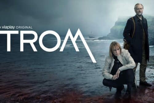
Thrilling 7 Hour TROM Sightseeing Tour
Tour startsTórshavnDuration7 hours -
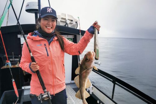
Refreshing 3 Hour Boat Tour including Fishing
Tour startsKaldbaksfjørður FjordDuration3 hours -
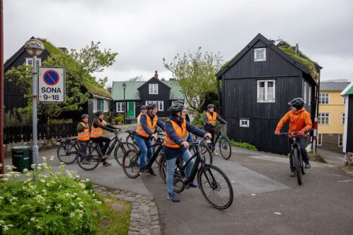
Tórshavn City E-bike Sigtseeing Tour
Tour startsTórshavnDuration2 hours -
Incredible 3 Day Faroe Islands Highlights Package
Tour startsTórshavnDuration3 days -
Personal Photographer Tour
Tour startsTórshavnDuration6 hours -

Spectacular 7 Hour Vágar Island Day Tour
Tour startsTórshavnDuration7 hours -
Private Escorted Tour of main Faroe Islands
Tour startsStreymoy IslandDuration6 hours -
James Bond Sightseeing Tour
Tour startsKlaksvíkDuration8 hours


Other interesting articles


