

Complete Guide to Suðuroy Island
Jump to chapter
Published: 08/08/2023
Reading time: 14 minutes
Where is Suðuroy Island? What is the island known for and what are the main attractions? Is visiting Suðuroy Island worth it? Read about the breathtaking southernmost island in the Faroe Islands. Find the best stops when exploring this unexplored gem.
- Browse the widest selection of Faroe Islands Tours and Activities
- Book a Vacation Package in the Faroe Islands
- See What to Pack for Faroe Islands
- Discover the widest selection of Car Rental in the Faroe Islands
Suðuroy is probably quite challenging to pronounce for most travellers to the isles. Do not worry, though, as exploring the island comes out much easier than trying to say ‘Suðuroy’. This is your guide to the island known for its outstanding western coastline filled with unbelievable sights.
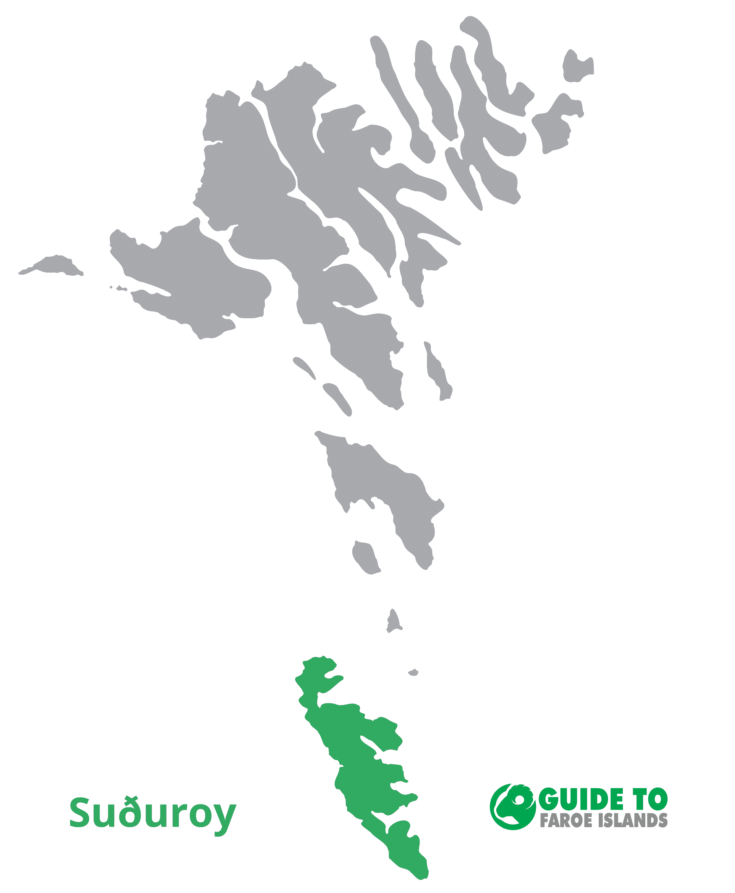
People quite often say that Suðuroy Island is the crown beauty of the Faroe Islands. There is a reason for this saying. Continue reading and get to know why this most southerly island is renowned for its timeless picturesqueness.
Suðuroy Island is a fairly unknown island among the wild 18 Faroe Islands. It is indeed a remote island in its true sense.

Imagine heading out into the swell of the North Atlantic Ocean. Once in this craggy outpost of Europe, take a ferry for two hours. That is how you reach this secluded island.
Suðuroy Island is still among the less visited islands in the archipelago. Once on the island, you might stumble upon a couple of travellers. But that is about it. There are super few people around who do not live on the island.
Getting to Suðuroy Island

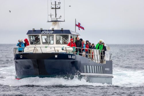
Tórshavn is the capital of the Faroe Islands and is also the only place from where you will get to Suðuroy Island. There is a single ferry taking travellers and locals ‘south’ as Faroe Islanders say. The ferry Smyril sails from Tórshavn to Tvøroyri between two and three times a day, depending on which day you plan to visit the island.
It takes two hours to sail from the capital to the fjord where the ferry docks on Suðuroy Island. As the ferry is large and well maintained, the ferry ride is always an enjoyable experience and very seldom a lumpy ride.

Moreover, the ferry is never sold out due to the size of the ferry. Embark the ferry at the Farstøðin terminal in Tórshavn without worrying about not getting a seat. Same goes if you bring a car. There is always room for all cars on the Smyril ferry.
The ferry has a nice cafeteria where you can have both breakfast if you take a morning tour or dinner when riding later in the day. It adds to the awesomeness of the food experience onboard that you will have an amazing view along the sailing route. From the meadow hills on Sandoy Island to the muffin look-alike island Lítla Dímun. Make sure to get a window seat when on the ferry!
Things to See & Do on Suðuroy Island
Despite its remoteness from the main islands explored by most travellers to the Faroe Islands, visiting Suðuroy Island is a great experience. Here are the main attractions that envelop the place all so worth it!
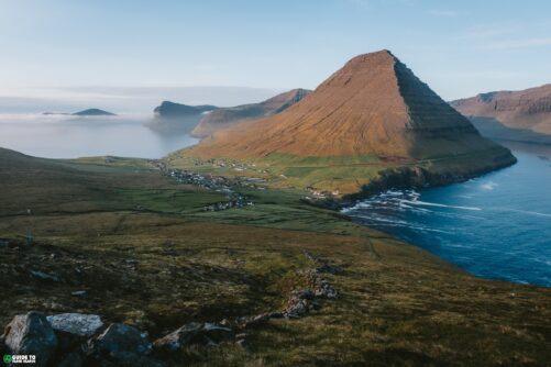
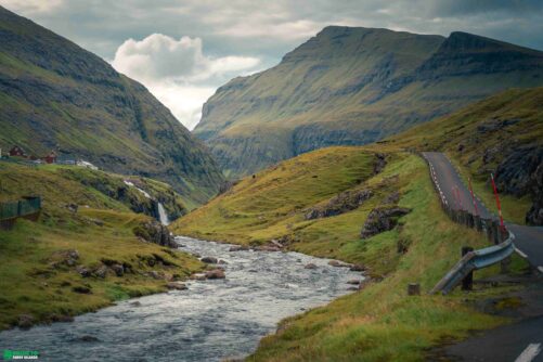
Start your itinerary by heading to the northernmost village Sandvík. From there, go south while exploring the stunning sights found at every turn. Cruising in a car with several pit stops is a great way to explore the island. It can be done in a day but staying here overnight or more is definitely also a great choice.
Sandvík

This village is known from the Faroe Islands saga where the legend Sigmundur Brestisson was killed off. He was executed in the gorge Sigmundsgjógv just after he swam across the Suðuroyarfjørður fjord from Skúvoy Island in order to get rid of his enemies.
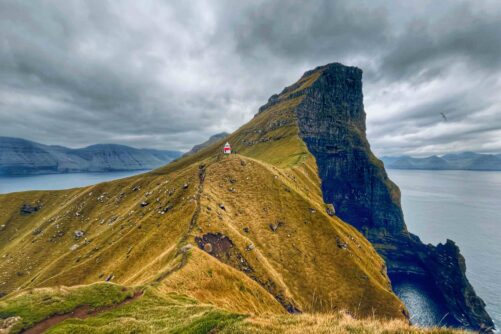
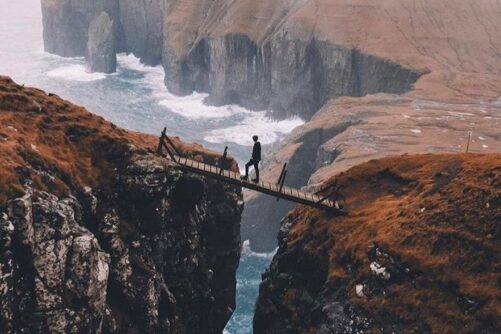
West of Sandvík lies the breathtaking Ásmundarstakkur sea stack. You can walk your way from Sandvík to this place. Alternatively, drive for some minutes west from Sandvík on an unpaved road. This will shorten the walk to some of the most lovely views.

There is a well-known wooden bridge that will get you over the Rituskor Clift. You will get gorgeous views of the Ásmundarstakkur rock formation from this place.
The bridge is not made for travellers so make sure to book this Guided hike to Rituskor. The guide will make sure that you are safe and sound at all times.
Hvalba

The village Hvalba has historically been the only place producing coal in the Faroe Islands. Today you can have a look inside the coal mine just to get a feeling of how the islanders used to get their supply of heating in the old days.
There are some really nice coastlines to admire when in Hvalba. Prioritise a visit to Norðbergseiðið og Fiskieiði. These two places in Hvalba will get you close to the craggy coastline for awe-inspiring views.
Tvøroyri

On your way to Tvøroyri from Hvalba, you can stop along the route and go for a short walk to Røðin. There is a telescope here which will give you a closer look at the sheer cliffs rising out of the sea.
Tvøroyri is one of two main villages on Suðroy Island. Here you will find shops, grocery stores, cafés and even a hospital.
When in Tvøroyri, you can go for a very easy hike to Froðbiarnakkur. This walk comes with rewarding views to the north.

Hvannhagi is another great hiking opportunity. For many locals, this is the number one nature hike on the island. It will take you one hour in each direction and get you to a peaceful lake and awe-inspiring views.
When in Tvøroyri, you can also check out the cultural house SALT. This venue has concerts every now and then and there is a café in the building once used as a salt warehouse.

The plantation in the village is also worth a visit. Here you can walk in peace in one of only a few places in the island group with threes all around you.
In the same fjord as Tvøroyri lies Tjaldavík. The attraction is uninhabited and has a nice beach used by the locals as their preferable place to swim. Yes, they swim in the cold North Atlantic Ocean and if you are up for it, try it yourself. It is cold and refreshing! Whilst swimming here, you will see the islet Tjaldavíksholmur in front of you.
Froðba
Froðba next to Tvøroyri will give you a close encounter of stabbagrót, which is hexagonal shaped basalt. It is indeed a fascinating sight.
These rocky columns are located at Kúlugjógv gorge. A bit further down the road lies ‘Holið í helli’ which is a cave accessible by food. You need to be fit to get to the cave.
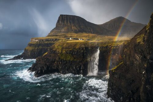
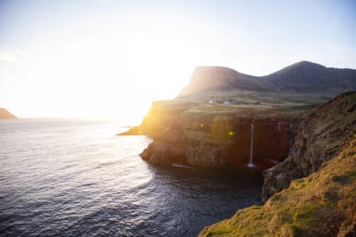
Fámjin
Fámjin is the only village on the island nestled on the breathtaking west coast. The views you get here are beautiful.
If you are up for a hike, you can find your way to Lake Kirkjuvatn. The surroundings make this lake located above the village Fámjin one of the top lakes to visit in the Faroe Islands.
The small church in Fámjin is home to the first Faroese flag ever created. Merkið, as the national flag is called, is worth a visit. You can have a look through the window if the church is closed.
Hov

In the small village of Hov, both nature and history unfolds. The settlement dates back to the Viking Age. You will see Viking excavations and burial places. The villagers dream of building a true Viking ship and the blacksmith for this purpose has been constructed already.
Hov includes the lovely valley Ergidal. You could also go trout fishing here. When arriving to How, you can take the either the mountain tunnel from Tvøroyri or the epic Hovsvegurin road perfect for a more scenic drive.
Porkeri

Further south lies Porkeri. This village dates many centuries back. Porkeri has an untouched beauty to it. There is a tranquility to it found when going for a stroll in the village.
What you will notice when walking the main street in Porkeri is a row of houses that look similar. This is the ‘Skipararøðin’, a chain of houses built and owned by captains in the former half of the 20th Century.
Make sure to also stop by Porkerisnes headland. There is a small lighthouse here with peaceful views.
Vágur
Vágur is the main village in the southern part of Suðuroy Island. You will find several shops and grocery stores in the village and lots of other services.
Make sure to stop by Vágseiði. This place will give you awe-inspiring coastal views. It is lovely on a chilly summer day and wild and impressive on windy winter days. The area is accessible all year round.
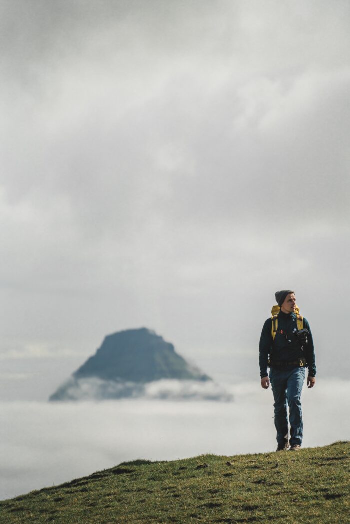
Eggjarnar Vista lies close to Vágur and is an out-of-this world viewpoint. You will see the western coast of Suðuroy unfolding in front of you towards the south. Just an incredible view! There is an unpaved road leading all the way to this amazing vantage point.
For those seeking some extra adventure, you have the option to walk from Eggjarnar Vista all the way to the mountain summit Rávan. There is a well constructed path leading up to the Rávan mountain peak.

Vágur has a great swimming pool called Páls høll. Have a swim here and enjoy the views of the wooden smack Johanna TG 326 moored on the fjord when sitting in one of the hot tubs located outside the indoor swimming pool.
The village is also home to an arts museum with paintings by Ruth Smith. She grew up along this fjord and lived here as a struggling female artist in the mid 20th Century. The Ruth Smith Art Museum is always worth a visit. Check the museum’s opening hours before dropping by.
Lopra & Akrar

Further south lies Lopra og Akrar. These two settlements are small and peaceful. Lopra is home to Kirvi, a local company producing the best bottled water in the Faroe Islands. The company is named after the mountain Kirvi rising above the tiny village.
Visit the Lopranseiði perched above the village Lopra for an epic view overlooking the rugged west coast of Suðuroy. This location sits next to the main road.
Sumba
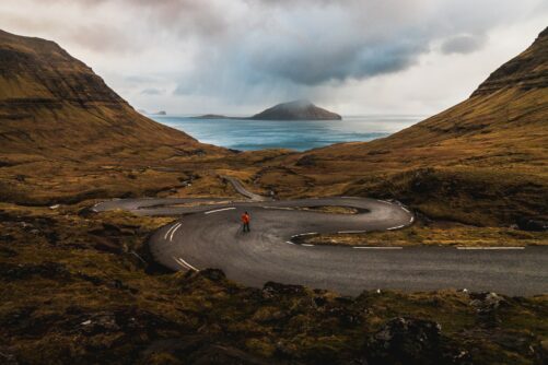
Sumba is the southernmost village on Suðuroy Island and in the entire Faroe Islands. Get to this stunning village either through the two-laned mountain tunnel or drive the breathtaking ‘um Hestin’ mountain road. The latter option is drivable as long as the road is snow-free.
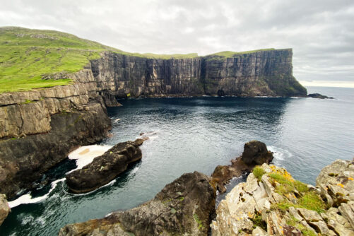
When taking the mountain road to Sumba, stop by the monumental Beinisvørð. This soaring sea-cliff rises 470 metres (1542 feet) above sea level. You can even walk to the top of the cliff. Just be very careful while there.
Beinisvørð Cliff – Suðuroy Island Highlight

What you can do is to take the mountain road to Sumba one way and stop at Beinisvørð. When heading back northbound from Sumba then drive through the mountain tunnel next to the settlement.
Those taking the ‘um Hestin‘ route to Sumba can make a pit stop in Víkarbyrgi, an abandoned place in elemental nature settings. You will get endless ocean views from this place.
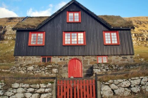
Now, find your way to Sumba. The villagers in Sumba are known for a rich dancing culture. The Faroese chain dance has its distinct expression in this far-flung corner of the archipelago. While you might not hear the singing and dancing when in the village, you will for sure notice another quality of the place; a gorgeous selection of colourful houses nestled in remarkable settings.

Sumba is exposed to the crashing waves during winter. Watching the waves, surf, and foam between October and April on windy days is something else.
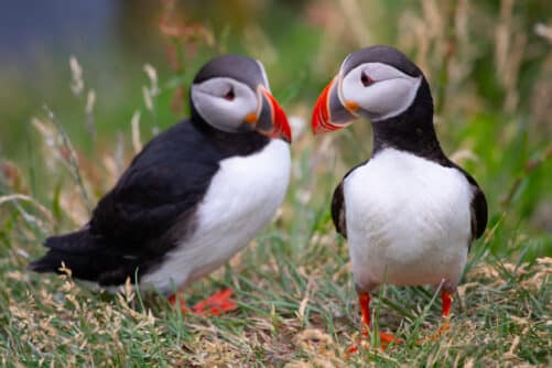
Sumba has a bird museum displaying many of the birds breeding in the Faroe Islands. The bird collection was a gift from Aksal l Poulsen, a local villager with a passion for ontology.
Akraberg
The very most southerly tip of the Faroe Islands is called Akraberg. Known for its white painted lighthouse with a red roof, make sure to experience the place.
There is a well maintained road all the way to Akraberg. Standing here on this remotely located island in front of the vast ocean will make you feel small and thankful.
Plan a Suðuroy Island trip

There are information centres on Suðuroy Island which are happy to help with any questions you might have whilst on the island. There is one information centre in Vágur and one information centre in Tvøroyri.
Contact them for museums, specific hiking routes, restaurants, and more! You can easily spend several days on the island and take your time to enjoy its rich nature. For those planning a day trip to the southernmost of the Faroe Islands, take a look at this Day Tour to Suðuroy Island ready to book.
More articles


Popular tours
-

Unique 1.5 Hour Boat Tour to Drangarnir
Tour startsSørvágurDuration1.5 hours -
Striking 8 Day Summer Package of the Faroe Islands with Top Attractions
Tour startsVágar AirportDuration8 days -
New Tour
Suðuroy Island | The Photography Tour
Tour startsTórshavnDuration9 hours -
Majestic 7 Hour Tour to the Northern Islands
Tour startsTórshavnDuration7 hours -
Breathtaking 6 Day Faroe Islands Summer Package
Tour startsTórshavnDuration6 days -
The Pick Me Up Tour | Faroe Islands
Tour startsDuration4 hours -
The 4 Day Photography Tour | Faroe Islands Highlights
Tour startsTórshavnDuration4 days -
Perfect 5-Day Vacation Package in Faroe Islands
Tour startsVágar AirportDuration5 days -
The Classic Faroe Islands Day Tour
Tour startsTórshavnDuration8 hours -

Spectacular 7 Hour Vágar Island Day Tour
Tour startsTórshavnDuration7 hours -
Norðradalsskarð, Sornfelli & Kirkjubøur | Private VIP Tour
Tour startsTórshavnDuration2 hours -
Original 1.5 Hour Vestmanna Sea Cliffs Boat Trip
Tour startsVestmannaDuration1.5 hours -
Thrilling 4 Hour Ásmundarstakkur & Rituskor Tour
Tour startsHvalbaDuration4 hours -
Beautiful 8 Hour Tour to Mykines Island
Tour startsTórshavnDuration8 hours -
Puffin Boat to Mykines Island
Tour startsSørvágurDuration45 minutes


Other interesting articles


