14 Best Hikes in The Faroe Islands (+Maps & Tips)
Jump to chapter
Published: 18/08/2023
Reading time: 25 minutes
What are the best hikes in the Faroe Islands? Which hiking routes will get you to the most stunning views? Are there any guided hikes available? Continue reading and learn everything about the top hikes in the Faroe Islands.
- Check out this Faroe Islands Hiking Package
- Hire a Personal Mountain Guide in the Faroe Islands
- Browse the world’s largest selection of Hiking Tours in the Faroe Islands
- Book a Vacation Package in Faroe Islands
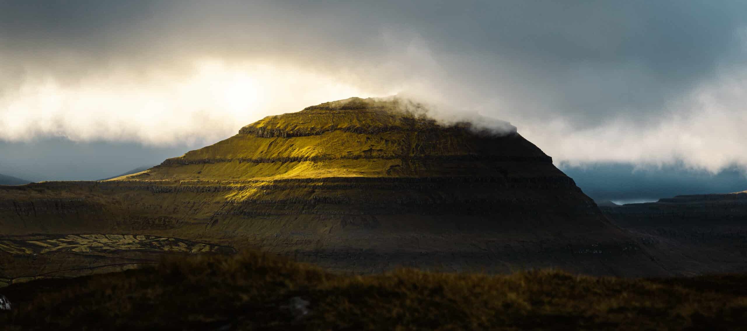
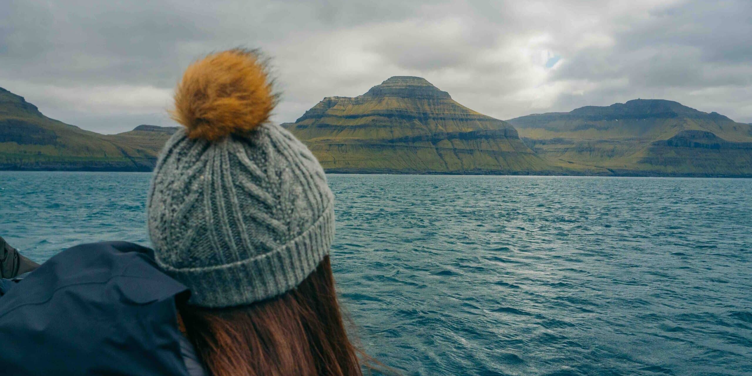
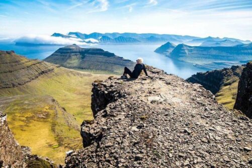
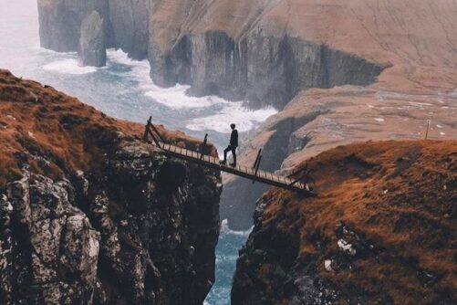
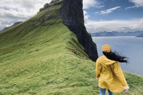
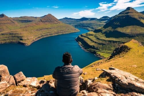
Get used to untouched nature, breathtaking cliffs, surreal pyramidal-shaped mountains, unpredictable weather, picturesque grass-roofed houses blended seamlessly in with the elements. All this and much more awaits you when hiking in the Faroe Islands.
When travelling to the secluded archipelago consisting of 18 wild islands in the North Atlantic Ocean, the ultimate way to explore the awe-inspiring nature is certainly hiking. Therefore, we have summed up all the best hikes for you to ensure that you will get a true feel of the island group! Furthermore, you will learn how to go hiking in the Faroe Islands when reading this article.
Hiking all Year Round
The great thing about Faroe Islands is that, thanks to its mild winters, some of the hikes can be enjoyed year-round! There are hikes that require more time and are best done during the bright summer season. It is a great idea to keep the seasons in mind and adapt your hiking plans accordingly.
Hiking in Spring

Hiking in the Faroe Islands in spring is great fun. The spring season starts in early April. The days will grow longer, nature awakens after stormy winter, and the birds and newly born lambs accompany you on hikes. Moreover, the tourist season is yet to begin, allowing you to enjoy most of the hikes on your own.
Hiking in Summer

Summer is when the dramatic landscapes of the Faroe Islands turn lush green contrasting with its rugged dark cliffs. This is the season of long daylight hours.
You will have daylight from early morning until late at night between early June to late August. The average temperature is 12°C (54°F). The summer offers unbelievably green coloured hillsides which blend perfectly with the blue ocean.
Hiking in Autumn

When visiting the Faroe Islands in autumn, it is good to keep in mind that the days become shorter and colder. The grass will get its beautiful autumn colours and this creates a special atmosphere.
You can still enjoy most of the hikes during this season. November and December is the hare-hunting season and hiking is only recommended with a guide.
Hiking in Winter

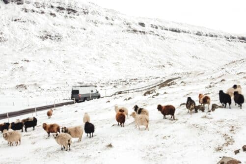
The winter will let you experience the most breathtaking sunrises. The days are much shorter during the darkest months.
Be ready to hike when the light is there. Due to a snow layer every now and then, not all hikes on this list are recommended during height of winter from November to February.
Good to Know Before Hiking
You can use this list of top hikes as a source of inspiration, taking into consideration the distance and difficulty of each trail. It is important to remain flexible and adapt your plans to the ever-changing weather in the Faroe Islands.
You might experience all four seasons within a matter of minutes while completing on the best hikes in the Faroe islands! Therefore, it is essential to check the forecast before you go out and about.

Certain weather conditions like thick fog can pose a serious threat. Having a local guide with you, will put safety first at all times.
The guides have the local knowledge which comes handy when nature behaves as… well, nature. Check out the widest selection of guided hikes here.
What to bring

When speaking to the locals, you will often hear them say that there is no such thing as bad weather, only bad clothing. Check out What to Pack for Travel in the Faroes and you are sure to be well prepared.
The key thing to know is to dress in layers. Hiking in a windproof jacket is always a good idea and make sure to bring proper hiking boots.
Local Outdoor Shop

If you should need any outdoor essentials while in the Faroe Islands, swing by Østrøm. Their store is located in Tórshavn city centre.
From walking sticks to high-performance footwear, the store will make sure that you get that last-minute upgrade. Østrøm has trendy outdoor clothing from top adventure brands for any adventure tour in the Faroe Islands.
The staff is keen to give you expert advice on the gear that best suits your plans. Any insider tips on how to go about getting to wondrous views and enjoying vivid green slopes, ask the friendly staff and they will be happy to help.
Now, let us dive into the top places waiting to be explored on foot. Without further ado, here is the list with the best hikes in the wild Faroe Islands.
1. Sunset Trail
Island: Streymoy Island
Length: 12,5 km
Route: Point-and-back
Duration: 3 hours
Total elevation 490 m
Difficulty: Easy
Sunset Trail is slowly growing in popularity. While more travellers hike Sunset Trail now than years ago, this is a favourite spot to walk for locals and has been for many years. Sunset Trail is a place for those seeking to enjoy the beauty of nature. The hike offers wonderful vistas all your round. You will find your way through some of the most magnificent mountains with beautiful, beautiful views along the route.
Reach the hikes trailhead from Tórshavn by car following the mountain road Oyggjarvegur. Eventually, turn left and continue to the area known as Skeiðsskarð. Park your car here. You will be able to spot the extraordinary Mount Sornfelli just above you. Mount Sornfelli is worth a visit as well; it is one of the best spots to watch a sunset if the weather allows.

From Skeiðsskarð, follow the gravel road to the left. After a couple of minutes you will reach an area full of bigger and smaller rocks. From here, continue on a path which has a little ascent and follow the cairns.
Initially, the trail may be a bit indistinct as several trails appear. Along the way, you can admire undisturbed views of Koltur Island and Hestur Island.

Continue towards the area called Vatndalsegg which translates to ‘The water valley’s edge‘. This part of the trail is a bit steep but relatively short.
Want to add local knowledge to the panoramic views? Book this Sunset Trail Hike to a hidden corner of Streymoy Island.
2. Lake Fjallavatn – Reipsáfossur Waterfall

Island: Vágar Island
Length: 16,6 km
Route: Loop
Duration: 4-5 hours
Total elevation 335 m
Difficulty: Moderate
This hike is ideal for those seeking a hike far away form the crowds. The second largest lake in the Faroe Islands, Lake Fjallavatn, is far less visited compared to the popular Lake Leitisvatn.
This easy, yet slightly longer hike, offers stunning views of the lake and passes by a few remote cabins. As you get near the end of the hike, the valley invites you to the most amazing views of the Reipsáfossur waterfall and a hidden black sand beach at Víkar.

The hike begins beyond a small parking lot at the end of a gravel road leading from the small village Vatnsoyrar. From the hike’s trailhead, follow the clear trail until you reach an old wooden bridge.
There is no clear trail after crossing the bridge so just head towards the lake. As you get closer, you need to cross a river and walk along the right side of the lake.

Follow the shore until the valley opens up. Avoid crossing right after passing the lake as the land is marshy behind the lake. Once you reach the viewpoint, continue walking along the other side of the lake. Eventually, you will find a sheep path which you can follow.
Overall, the most challenging part of the hike is crossing the river at the beginning and when returning after reaching the viewpoint. Lake Fjallavatn is a stunning experience for outdoor enthusiasts.
3. Bøur – Gásadalur

Island: Vágar Island
Length: 8,4 km
Route: Point-and-back
Duration: 3 hours
Total elevation 1029 m
Difficulty: Moderate
This scenic hike will let you experience a stunning view of Gásadalur, the most famous of all small hamlets in the Faroe Islands. Moreover, this place used to be the most remote village in the island group. These days, the village is accessible through a mountain tunnel which opened in the new millennium.
Hiking your way to this attraction is perfect for those who enjoy undisturbed views and an exciting mountain adventure. Along the way, you can admire the incredible sights of Drangarnir sea arch, the uninhabited Tindhólmur islet, and the bird paradise, Mykines Island. To explore these unique sights up close, make sure to book the boat tour to Drangarnir.

The hike begins right before the Gásadalstunnilin tunnel to the tunnel’s left hand side. Here you will reach an unpaved road. Start the hike from this place and follow the well-marked trail all along the route.
After some pit stops to recharge your energy, you will be rewarded with the most impressive view of Múlafossur waterfall and the lovely valley home to this famed attraction. Go for a stroll in the village and soak in its remoteness. You have the option to hike the same way back or arrange a pickup in the village.
The hike from Bøur to Gásadalur is not for the faint-hearted, but those who do push through will be rewarded with a stark landscape rich in natural beauty. Book a Guided Postman’s Trail Hike to Gásadalur for a true local experience.
4. Eiðiskollur Cliff

Island: Eysturoy Island
Length: 5 km
Route: Point-and-back
Duration: 3 hours
Total elevation 352 m
Difficulty: Moderate
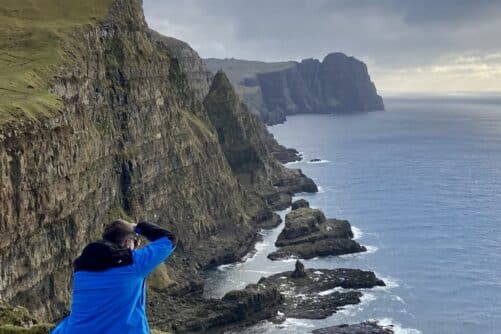
Eiðiskollur Cliff is an iconic place in the Faroe Islands. You can enjoy the impressive beauty of it all year round. Eysturoy Island will let you experience wild vistas, dramatic cliffs and abundant seabirds.
The culminating viewpoint of the hike served as a watchtower during World War II. There are only some signs of concrete left from that era.

It all starts in the village Eiði in the norther part of Eysturoy Island. The island and all its villages are easily reach by car from the capital, Tórshavn.
First part of the hike is fairly easy and just follow the grassy and sometimes muddy path up hill. Enjoy stunning views of the nearby Streymoy Island as you ascend. The last part of the hike is quite steep. Nevertheless, nothing can really stop you from reaching the stunning views from the ruins of the watchtower!

Once you reach the lofty summit of Eiðiskollur Cliff, breathtaking panoramic views unfold in every direction, raw and untamed. The iconic sea stacks Risin and Kellingin shoot majestically from the crashing waves beneath you.
To the west you will see the mighty Mount Mýlingur in all its glory. Please be aware that the top of Eiðiskollur Cliff is often cloaked in mist. Experiencing this place during the golden evening hour is epic and is more likely to give you clear views as skies tend to drift away in the late hours before it gets dark.
5. Klakkur Mountain Ridge
Island: Borðoy Island
Length: 6 km
Route: Point-and-back
Duration: 1-2 hours
Total elevation 147 m
Difficulty: Easy
The best thing to do when in Klaksvík is to hike to Klakkur! This short and easy hike will take you to an incredible mountain ridge overlooking Kunoy Island and the other surrounding islands nearby. Moreover, it is a perfect spot for sunsets when the weather conditions allow. The short distance from the start to the end makes this one of the best hikes in the Faroe Islands.
The trail is easy to follow, taking you through a grassy terrain and a moderate ascent, providing a perfect view over Klaksvík. To get to the starting point, follow the gravel road Niðan Horn until you reach an unpaved parking area in front of a gate. This hike is one of the easier ones and can be enjoyed year-round, weather permitting.
6. Fuglafjørður – Rustartindur

Island: Eysturoy Island
Length: 5 km
Route: Point-and-back
Duration: 2-3 hours
Total elevation 470 m
Difficulty: Moderate
This hike is a real gem of all hikes in the Faroe Islands. A lesser known adventure typically not on travellers’ bucket list. The hike offers spectacular views and gives you a sense of being in one of the most remote places on earth!
The hike begins next to the football field in the village Fuglafjørður, which translates to “the fjord of birds”. Fuglafjørður truly lives up to its name. Start walking along the path called Skarðsrás and continue uphill, passing two different gates until you reach the outfield. Here it might be challenging to spot the path but if you look at a slight right angle, you will see the first cairn approximately 500 metres (1649 feet) away. Keep going uphill until you come across a large cairn at the mountain pass. From here, facing Fuglafjørður village, turn left and continue uphill, following the blue wooden sticks in the grass until you reach the viewpoint from Róvin mountain.
You have two options when returning. Take the same way back to Fuglafjørður or head to another trail from the large cairn at the mountain pass and finish your hike in the village Hellurnar. Want even more epic views? Then make sure to walk an additional 2,5 km (1,6 miles) to reach a lovely beach in Hellurnar. When the ocean is fairly calm, you can enjoy a refreshing dip. To get there, stand turned back towards Fuglafjørður village, start following the wooden sticks in the grass in front of you on the right side from the huge cairn at the mountain pass.
7. Mount Villingadalsfjall & Cape Enniberg
Island: Viðoy Island
Length: 7,7 km
Route: Point-and-back
Duration: 3-4 hours
Total elevation 1,306 m,
Difficulty: Difficult
Mount Villingadalsfjall is the third highest summit in Faroe Islands, located near the northernmost village called Viðareiði. This hike offers outstanding views of the surrounding islands both during ascent and descent.
The route is mostly marked with blue plastic tubes and later with cairns, guiding you almost all the way to the top. The hike begins with grassy terrain and a gradual ascent. As you gain elevation, the terrain becomes rockier.

Continuing to Cape Enniberg is challenging due to loose stones and the risk of getting lost. Therefore, it is highly recommended to let a guide accompany you on this tour. You can book a guided Cape Enniberg tour to optimise safety and gain all the other benefits including the knowledge of a local guide.
One important thing to know about Mount Villingadalsfjall is that the mountain itself is often covered in clouds. When this is the case, make sure not to do the hike. The visibility will be poor and you will get no views. For the best experience, book your guided hike to Mount Villingadalsfjall.
8. Lake Leitisvatn – Trælanípa Cliff
Island: Vágar Island
Length: 7,2 km
Route: Point-and-back
Duration: 1,5-2 hours
Total elevation 369 m
Difficulty: Easy
A hike along Lake Leitisvatn to Trælanípa Cliff is a dream place for many travellers. The lake is also called Sørvágsvatn. This is an easy hike not to be missed when visiting the Faroe Islands. Beside the views you get, what makes this hike special is the fact that it can easily be done people of all ages. The path is well maintained making this famed attraction accessible all year round.
This hike does not require any hiking skills, except when crossing a few tiny streams and a final, slightly steep elevation. At this point, take your time and enjoy several stops to observe the calm seagulls, listen to the waves, and slowly make your way uphill to reach the final viewpoint.

From Trælanípa Cliff, you will be rewarded with a breathtaking sight of the lake, seemingly floating high above the ocean and gorgeous cliffs. You can continue your walk just a little further to reach Bøsdalafossur Waterfall. From here you can also spot the spectacular sea stack Geituskorardrangur in the distance.
If you stay in Tórshavn, make sure to book a Guided tour to Lake Leitisvatn. This will secure you a truly unique local experience while enjoying the lake, the cliffs and more!
9. Lake Hvannhagi

Island: Suðuroy Island
Length: 5-7,5 km
Route: Point-and-back/loop
Duration: 2-3 hours
Total elevation 200 m
Difficulty: Moderate
Ready for some breathtaking views? Make sure to prioritise Hvannhagi. This hike is a must-to do if you decide to explore the southernmost Suðuroy Island. Hvannhagi is a lovely valley nestled in a remote part of a remote island. This place features a lake that faces the unique island Lítla Dímun.
The hike begins just above the hospital in the village Tvøroyri. This is the same village where the ferry from Tórshavn arrives. You can park your car in front of the trailhead and follow a well-marked trail. After enjoying the stunning scenery, simply follow the same trail back.

If you are an experienced hiker seeking a more adventurous route, you can start the hike at a gate in Ovari Vegur, the highest road up the mountain in Tvøroyri, and ascend until you reach a sheep gate. From there, begin your descent on the rugged trail surrounded by steep mountains.
Be aware of this area, as loose gravel and stones require sure footing. On the way back, follow the official well-marked trail starting from the lake on the right side when facing Lítla Dímun.
10. Ásmundarstakkur
Island: Suðuroy Island
Length: 5 km
Route: Point-and-back
Duration: 1,5 hours
Total elevation 272 m
Difficulty: Easy
Getting to views of the Ásmundarstakkur sea stack is quite an easy task if you travel around Suðuroy Island by car. Considering how challenging hikes in the Faroe Islands can be, this is a super easy one. Nevertheless, you will enjoy remarkable views of a sensational rock formation surrounded by magnificent cliffs, far away from the crowds and any kind of city noise.
The views are even more stunning from the mountains on the left side where you can discover two large gorges. There is a tiny hidden wooden bridge over the second gorge, called Rituskor.

Be prepared to loose your breath as the scenery unfolds in front of you. Sit in the grass at a safe distance from the gorge and simply enjoy the untamed nature.
The hike begins in the small village Sandvík on Suðuroy Island. Follow the Heiðavegur road from Sandvík until you reach a farm. You can leave your car here and pass a gate. Now, follow the gravel road. The path is super easy to follow.

You will cross a couple of streams on your way towards the Ásmundarstakkur viewpoint. The scenery will be even more fabulous if you continue your hike up to the magical wooden bridge to Rituskor.
Start hiking left straight up towards the twin gorges. You will meet the first gorge and find a metal rope with a fence. Be sure to keep the fence on your right while ascending.
It is steep but after a little while you will reach the bridge and enjoy fabulous views of Ásmundarstakkur. Remember to stay safe! If the weather conditions are not suitable, skip crossing the bridge. For the best experience of this place, book your Guided tour to Ásmundarstakkur.
11. Kambsdalur – Skálafjørður

Island: Eysturoy Island
Length: 7,8 km
Route: Point-and-back
Duration: 3 hours
Total elevation 389 m
Difficulty: Moderate
This hike will take you to Skálafjørður, the longest fjord in the Faroe Islands. Along the way, you will experience a great variety of landscapes.
From grassy valleys, rugged mountains and rocky shorelines, this hike has it all. You will walk along the peaceful lake Trælavatn and enjoy the birdlife there.

Lake Trælavatn is home to a large colony of Herring Gulls during the bright summer months. There are other bird species in this area too.
The hike starts from the street Børkugøta in Kambsdalur, the suburb of the town Fuglafjørður. In Kambsdalur you will find a sign for a well-marked trail to Lake Trælavatn.

There are short wooden poles coloured blue marking the route all the way. Follow these sticks from the village Kambsdalur.
First, you will hike up towards the edge of the gorge Skarðsbrúgv. You will find a cairn here and several other cairns along the route. This place comes with outstanding views of Fuglafjørður, surrounding mountains and the pristine fjord.

Continue following the blue wooden poles up to Lake Trælavatn. From here, you will follow the lake on its western side which will lead you to an uneven and rocky path.
Cairns used to be the only guidance here. Now the blue wooden sticks in the grass help travellers navigate the terrain. Hike down toward Rossastígar. Be careful as it is steep in some places. Make sure to stay on the left side of the river Tundradalur.
12. Dunnesdrangar

Island: Vágar Island
Length: 5 km
Route: Point-and-back
Duration: 2,5 hours
Total elevation 180 m
Difficulty: Easy
Dunnesdrangar is a coastal rock formation in outstanding surroundings. During this hike, you will walk through the grassy terrain next to Vágar Airport.
It all starts from the kindergarten in the village Sørvágur. There is a parking lot here.

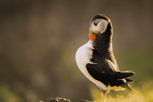
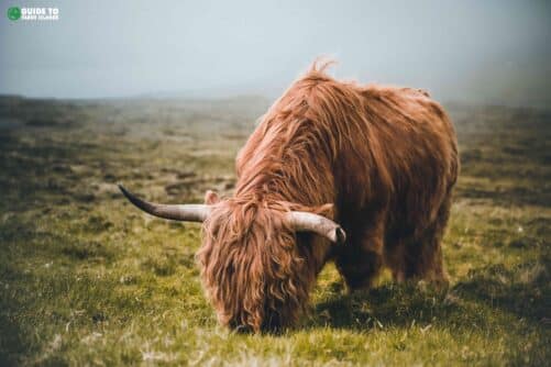
Park for free and off you go. Encounter friendly sheep as you find your way to the cliff’s edge where the views are waiting. You might be even lucky to see puffins if you hike during the breeding season.
There is no real path but the route is easy to walk. Please note that this hike now requires a guide. Book the Dunnesdrangar Hike with a local guide.
13. Klaksvík – Katlarnir

Island: Borðoy Island
Length: 8,5 km
Route: Point-and-back
Duration: 3-4 hours
Total elevation 395 m
Difficulty: Moderate
This inspiring hike is the perfect option for those accommodated in Klaksvík and who want to explore its surroundings. Hike to breathtaking Katlarnir along beautiful landscapes.
Katlarnir is a historic place which used to serve for governing assemblies in the Northern Islands. This place is marked with a large boulder called Tingsteinurin (the Thing Stone).

Be prepared for awe-inspiring views. From Katlarnir, you will get an incredible view over Árnafjørður, a picturesque settlement surrounded by stunning fjord and wild mountains.
The hike starts from the street Undir Kráarbrekku 21 in Klaksvík. The trail is well-marked all the way, although after reaching the mountain pass Áarskarð it is difficult to spot the first cairn. Want this hike with a local tour guide? Look no further. Book this Hiking Tour on Borðoy Island.

Descent diagonally a few metres to your left side, and you will be able to spot a big cairn. From this point, it is easy to follow the trail again.
After crossing a fence, you will be able to see the Thing Stones and enjoy the incredible views of the fjord and its surrounding mountains. This hike requires careful footing as you cross several streams, rocky areas and it can be slippery at times as well.
14. Tórshavn – Kirkjubøur

Island: Streymoy Island
Length: 11 km
Route: Point-and-back
Duration: 1,5 hours
Total elevation 212 m
Difficulty: Easy
This traditional hike begins in the capital of Tórshavn. So if you are staying in Tórshavn, this nice walk is just around the corner. Hiking your way to Kirkjubøur will give you the chance to go deep into the history of the Faroe Islands.
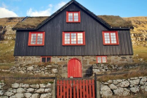
Kirkjubøur is known for its wooden farmhouse, which is one of the oldest in the world of its kind. As many other buildings in the village, is painted black with red windows and a sod roof. There are plenty of sights to see in Kirkjubøur, including the ruins of an old cathedral known as Kirkjubømúrurin. You will the oldest church in the Faroe Islands still in use, Ólavskirkjan.

The is located close to the river Sandá, leading from the Gamli Velbastaðvegur road in Tórshavn. You can also start from the suburb Argir and follow the river.
This hike starts out with an ascent for some minutes and later continues as a pleasant walk on a well-marked path with cairns all the way. The path goes through grassy terrain, which can be muddy at times. Some parts can be a bit rocky.

Along the way, you may encounter several birds and sheep as well as friendly horses. If you are lucky, you might be able to spot a curious seal in Kirkjubøur as well.
This easy hike can be enjoyed all year round, weather permitting. You can hike in both directions, or alternatively, take the advantage of the free public bus service in Tórshavn. You can enjoy this popular walk with a local when joining this Guided tour from Tórshavn to Kirkjubøur.
Wrapping up Hikes in the Faroe Islands
The Faroe Islands have an impressive number of great trails to offer for everyone. Presented above are the best hikes in the Faroe Islands for your inspiration. While out hiking, soak in the elements around you and enjoy untouched views of mountains, valleys and the wilderness. Regardless of which hike you choose, you are bound to have the time of your life!
Browse the largest selection of Guided Hiking Tours ready for you to book. Find those hikes in the Faroe Islands that you really want to go for and take the next step.
More articles
Popular tours
-
Tranquil 4 Day Winter Trip of the Main Faroe Islands
Tour startsVágar AirportDuration4 days -
Refreshing 3 Hour Boat Tour including Fishing
Tour startsKaldbaksfjørður FjordDuration3 hours -
Panoramic 6 Hour Tour to Mount Slættaratindur
Tour startsTórshavnDuration6 hours -
Thrilling 4 Hour Ásmundarstakkur & Rituskor Tour
Tour startsHvalbaDuration4 hours -
Best 8 Hour Private Mykines Day Tour
Tour startsTórshavnDuration8 hours -
Kalsoy Island | The Photography Tour
Tour startsTórshavnDuration7 hours -
Spectacular 7 Hour Eysturoy Island Day Tour
Tour startsTórshavnDuration7 hours -
The Classic Faroe Islands Day Tour
Tour startsTórshavnDuration8 hours -
Amazing 6 Day Self Drive Tour of Faroe Islands
Tour startsVágar AirportDuration6 days -
Travel With a Local | Go As You Please
Tour startsTórshavnDuration7 hours -

Classic 6 Day Summer Package of the Faroe Islands
Tour startsTórshavnDuration6 days -
Spectacular 8 Hour Streymoy Island Day Tour
Tour startsTórshavnDuration8 hours -
Private Tour With Filmmaker as Guide
Tour startsTórshavnDuration5 hours -

Unordinary 3 Hour Tour on Lake Above the Ocean
Tour startsLake LeitisvatnDuration3 hours -

The 5 Day Photography Tour | Faroe Islands Highlights
Tour startsTórshavnDuration5 days


Other interesting articles